
Eliminates the complicated preparations required for traditional laser operations, while offering a broader range for precise levelling operations.
FJD 3D Land Levelling System
Levelling for the Next-level Yield
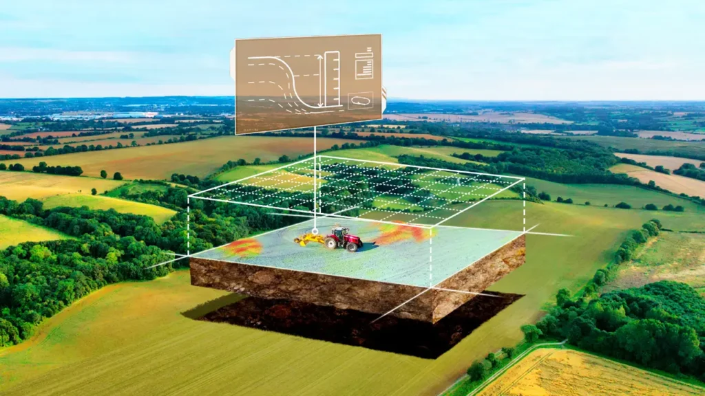
FJD 3D Land Levelling System utilizes GNSS & RTK high-precision positioning technology to provide comprehensive solutions for farmland levelling and terrain planning.
Our system ensures a smooth and uniform terrain through precise terrain survey and design, substantially enhancing water management and crop production in your field.
3D Land Levelling Features
High-precision positioning technology to provide comprehensive solutions for farmland levelling and terrain planning.
Explore Multiple Options…
Discover the future of land levelling with FJD’s advanced 3D Land Levelling Kits. Whether you opt for the robust FJD AL01 or the automatic FJD AL02, you’re choosing precision, reliability, and performance that’s second to none.
FJD AL01
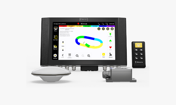
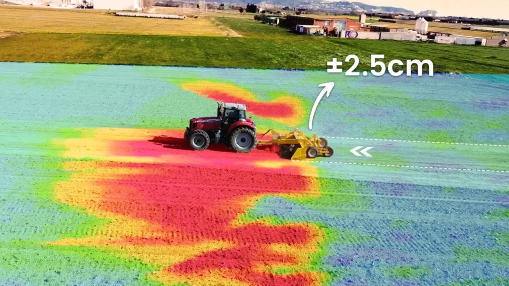
Say hello to the AL01, the GNSS-based land levelling system that achieves 2.5 cm accuracy, increases efficiency by 40%, and covers a larger area in comparison
FJD AL02
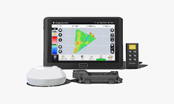
Based on GNSS & RTK technology, the AL02 eliminates the complicated preparations required for traditional laser operations, while offering a broader range for precise levelling operations
GNSS-based Land Levelling System
Say goodbye to the laser system’s troubling setup, limited signal coverage, and demanding weather conditions. Say hello to AL01 / AL02 – the GNSS-based land levelling system that achieves 2.5 cm accuracy, increases efficiency by 40%, and covers a larger area in comparison.
Note: Accuracy varies in conditions. The comparison of efficiency and signal coverage takes place under the same environment and with the same machinery configuration.
FJD AL01 BENEFITS
The advanced mode allows for an efficient and rapid creation of a project. First, set the master and secondary benchmarks, followed by drawing the field boundary and collecting interior points. Lastly, complete the design surface through parameter setting. All tasks are completed in a single workflow.
Terrain Survey
The AL01 collects elevation data through boundary mapping and internal points collection, significantly eliminates environmental interference and ensures long-term operational efficiency and accuracy.
Terrain Design
You can easily complete terrain designs through parameter settings and getting analytics like fill-and-excavation and earthwork movement. Moreover, you can also effectively trim terrain angles with slope terrain design, and set water flow direction for better water management.
Record Reserve
Completed levelling tasks are automatically saved to your task list, therefore, you can access historical records of the entire process at any time to avoid duplicate work by reusing previously saved task records.
Save Money & Time
↑ 40% Work Efficiency
↓ 10% Fuel Consumption
↓ 22% Water Consumption
Extensive Features
By managing water through precise system control and minimizing earthwork, the AL01/02 levels the land to its optimal condition, significantly improving crop growth and survival rates.
AL02 Versatile
Functionalities
Use FJD Land Levelling System to reclaim wasteland, consolidate and level fields, convert slopes into terraces, and optimize water usage for rice paddies.

FMS Enhancements
Get Your Auto Steer Connected
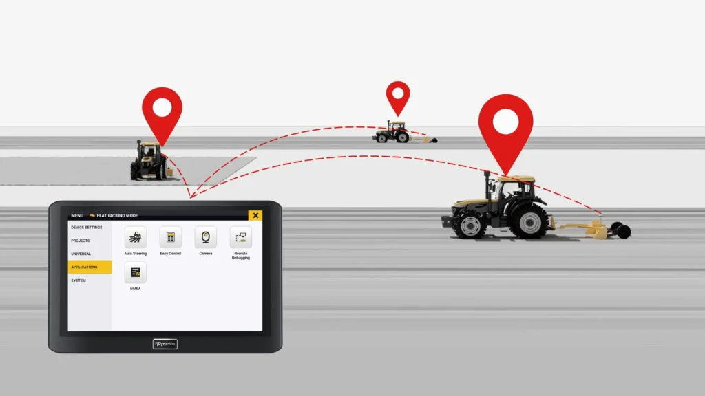
Enhance your farming operations by integrating the FJD 3D Land Levelling System with your Farm Management System (FMS).
The FJD AL01 / AL02 3D Land Levelling System seamlessly synchronizes operational data and executes pre-planned tasks assigned from FMS, such as establishing boundary lines and guidance paths.
You Might Also Like



Speak to our Specialists today!
Get in touch with us today and have a chat with our friendly specialists to discuss the product in more detail, and the options available.